
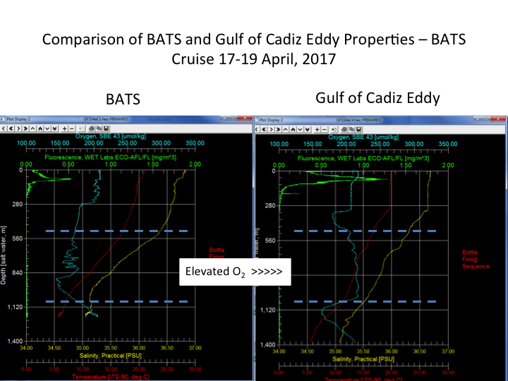
The strong anticyclone gyre has tracked mostly west and slightly south and appears to be headed for an intersection with BATS with the eddy’s center about 20 km south of BATS. Jack’s track for the past week or so has allowed it to circle the eddy and the glider is now on a northerly track through the eddy center. Profiles of T, S, and O2 are beginning to show the elevated values that are typical of a Gulf of Cadiz eddy (see the 9 April 2017 update). During the most recent BATS cruise, the BATS team searched for the eddy center and produced a vertical property profile for comparison with current conditions at BATS.
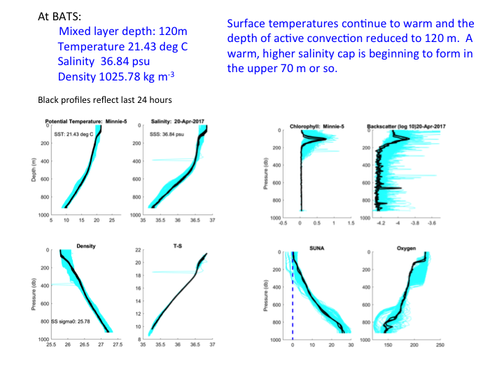
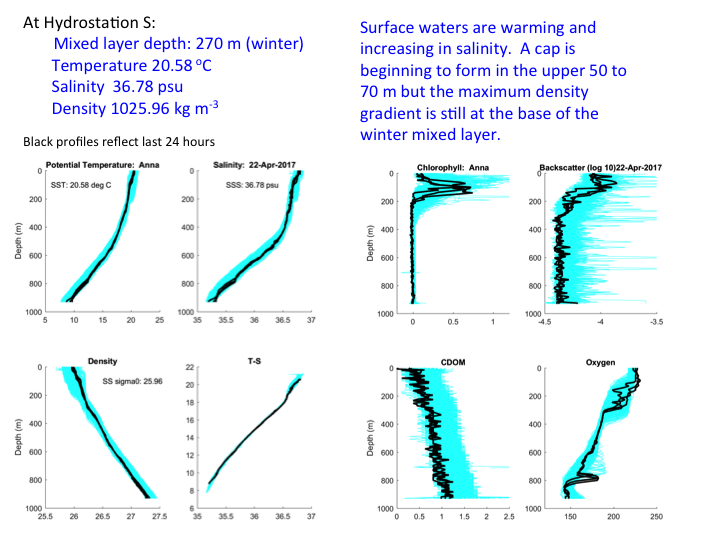
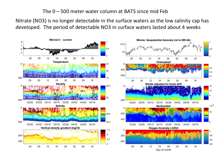
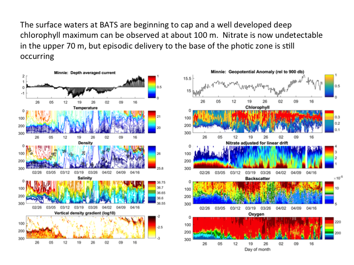
Anna and Minnie remain in place profiling at Hydrostation S and BATS, respectively, and both locations are warming and beginning to form cap in the upper water column near the surface. SSTs at BATS are 21.43 degrees C and at Hydrostation S are 20.58 degrees C. The mixed layer depth at BATS is now about 120 m, based on maximum density gradient, and a shallower cap is forming in the upper 70 m, above which nitrate (NO3) is no longer detectable. The chlorophyll maximum is located at about 100 m.
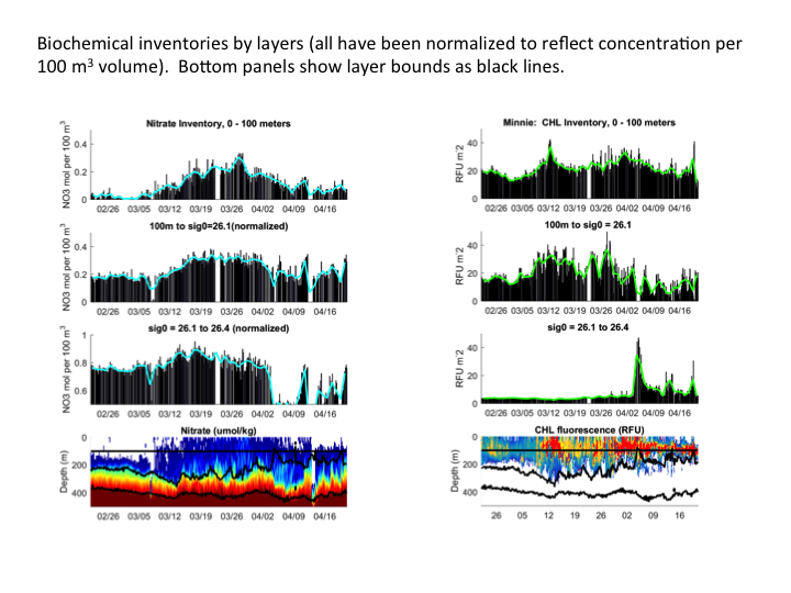
Vertical mixing appears to still be occurring below the photo zone but above the winter mixed layer transition zone at about 300 m. Elevated nitrate levels are no longer seen above about 70 to 100 m, although several episodes of vertical delivery of NO3 to the lower photic zone have occurred in the last week or two. The impact of the recent, strong vertical delivery of NO3 can be seen in the inventory plots as increased levels of chlorophyll and O2. During the interval of detectable NO3 in surface waters (from about 8 March to 9 April 2017) higher levels of chlorophyll are observed as well as an increasing O2 concentration reflecting an increase in productivity.In the last two weeks, the O2 levels from 200 to 300 m have significantly increased. It is unclear if this increase is locally produced or the result of advection.
-

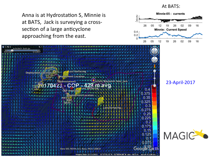
- The eddy field near BATS on 23 April 2017
-
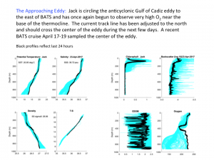
- Profiles from Jack as it crosses the anticylonic eddy east of BATS

-
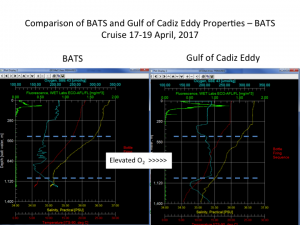
- Profiles from BATS (left) and the center of the eddy (right) from 17-19 April 2017 during the most recent BATS cruise
-
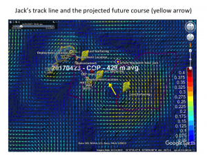
- The anticipated track line for Jack as it crosses the center of the eddy

-

- Current conditions at BATS
-
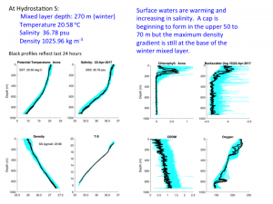
- Current conditions at Hydrostation S
-

- Time series of the water column at BATS (0-500 m)
-

- Time series of the water column at BATS (0-300 m)
-

- Nitrate and chlorophyll inventories at BATS
-
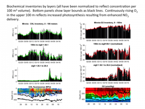
- Chlorophyll and dissolved oxygen inventories at BATS
